
Estimating Hiking Time: A Case Study of Qilai North Peak
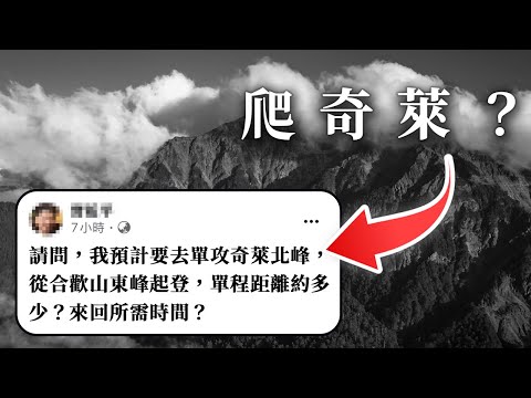
Hello everyone, I'm Xiao Bai. Recently, a question arose in a hiking community about the time required for a solo hike to Qilai North Peak from Hehuan Mountain. While the hiker believed it was simply a matter of time difference if one follows the trail, many disagreed. I want to explain why I also advise against this plan and discuss how to estimate hiking time using resources like the Shanghe map.
Understanding the Question: Hehuan Mountain to Qilai North Peak
Clarifying the Starting Point and Route
The initial question was about the time to hike from Dongfeng in Hehuan Mountain to Qilai North Peak and back. However, the actual starting point for both Hehuan Mountain East Peak and Qilai North Peak is closer to Songxuelou. Therefore, I'm assuming the hiker meant going to Qilai North Peak from Songxuelou.
Importance of Distance and Elevation Gain
For any solo or day hike, knowing the distance and elevation gain is crucial. Instead of asking on social media, a quick internet search can provide this information. Searching for "Qilai Beifeng distance" or "Qilai Beifeng GPX" will yield relevant data.
Avoiding Misinformation
When researching, be careful not to confuse the Qilai North Peak route with the Qilai Main Peak route, as the distances and elevation gains differ. Consulting multiple sources is a good way to establish an average distance. The round trip distance to Qilai North Peak is approximately 14 kilometers with a climb of about 1,500 meters.
The Problem with Estimating Time Based on Others' Data
Individual Differences in Hiking Ability
The main issue with relying on other people's hiking times is the vast difference in physical ability and experience. Asking someone how long a hike will take is like asking a stranger how many chips you can eat – impossible to answer without knowing your individual capacity.
Using Others' Times as a Reference
Instead of directly copying someone else's time, use it as a reference point. Compare multiple samples to get a range of possible times. Even in my solo hiking videos, I emphasize the general time required, acknowledging that my pace might be significantly faster than average hikers. I will usually mark the time a general person needs to spend, which is 11 to 14 hours in general.
Using the Shanghe Map for Time Estimation
Introducing the Shanghe Kaoshan Baiyue Map
Shanghe Culture publishes a map of Taiwan's Baiyue (100 Peaks) and Xiaobaiyue, including time estimates for various routes. This map can be found by searching "Shanghe culture" on Google and looking for the "2020 Kaoshan Baiyue Dixing Tu" map. I will also include the URL in the description below.
Understanding the Shanghe Time Standard
The time estimates on the Shanghe map are based on a group of 5-6 people, with male hikers carrying around 25 kg and female hikers carrying around 18 kg. While the map doesn't explicitly state it, these times are typically for light-loaded hikes from Taoshan to Kraye.
Calculating Your Personal Hiking Pace
To use the Shanghe map effectively, you need to determine your personal hiking pace relative to their standard. A fellow hiker previously walked to Xiduoli Duanyai in 7 hours. Xiduoli is located 3.8 km from the mountain, which translates to 4 hours and 40 minutes on the Shanghe scale. Comparing the two, the fellow hiker took 1.5 times longer than the Shanghe estimate.
Applying the Pace to New Routes
Knowing this 1.5x factor, we can estimate the hiker's time for Qilai North Peak. The Shanghe time for the route from Songxuelou to Qilai North Peak is about 13.5 hours. Multiplying this by 1.5, we get an estimated 20 hours for the hiker to reach Beifeng alone.
Additional Considerations and Cautions
Terrain, Load, and Fatigue
This 20-hour estimate doesn't account for the challenging terrain, the weight of the hiker's pack, or the effects of long-term fatigue. The Qilai North Peak trail is more difficult than the one to Xiduoli, with steeper sections, uneven terrain, and rope climbs. If Xiduoli already feels dangerous, Qilai North Peak would be more so.
Step-by-Step Approach
This is why I and others advised the hiker to start with shorter solo hikes to build experience. It's not simply about reaching the destination; proper preparation and a gradual approach are essential.
Dynamic Time Estimation
The Shanghe map can be used at any point during your hike for re-evaluating time estimates. For instance, if you are at Paiyun Mountain Village and heading to Yushan Main Peak, you can use the Shanghe times for those sections and adjust based on your current pace. This allows for real-time adjustments to your plan.
Conclusion
In conclusion, while the Shanghe map provides a valuable framework for estimating hiking time, it's crucial to understand its limitations and adjust based on individual abilities, terrain, and other factors. The key is to have enough samples to compare with in the part of your own steps, and the journey needs to be long enough. I hope this explanation was clear. If you have any questions, please leave them in the comments below. I'm Xiao Bai. See you next time. Bye.